Student Perspectives on Fieldwork in Siberia

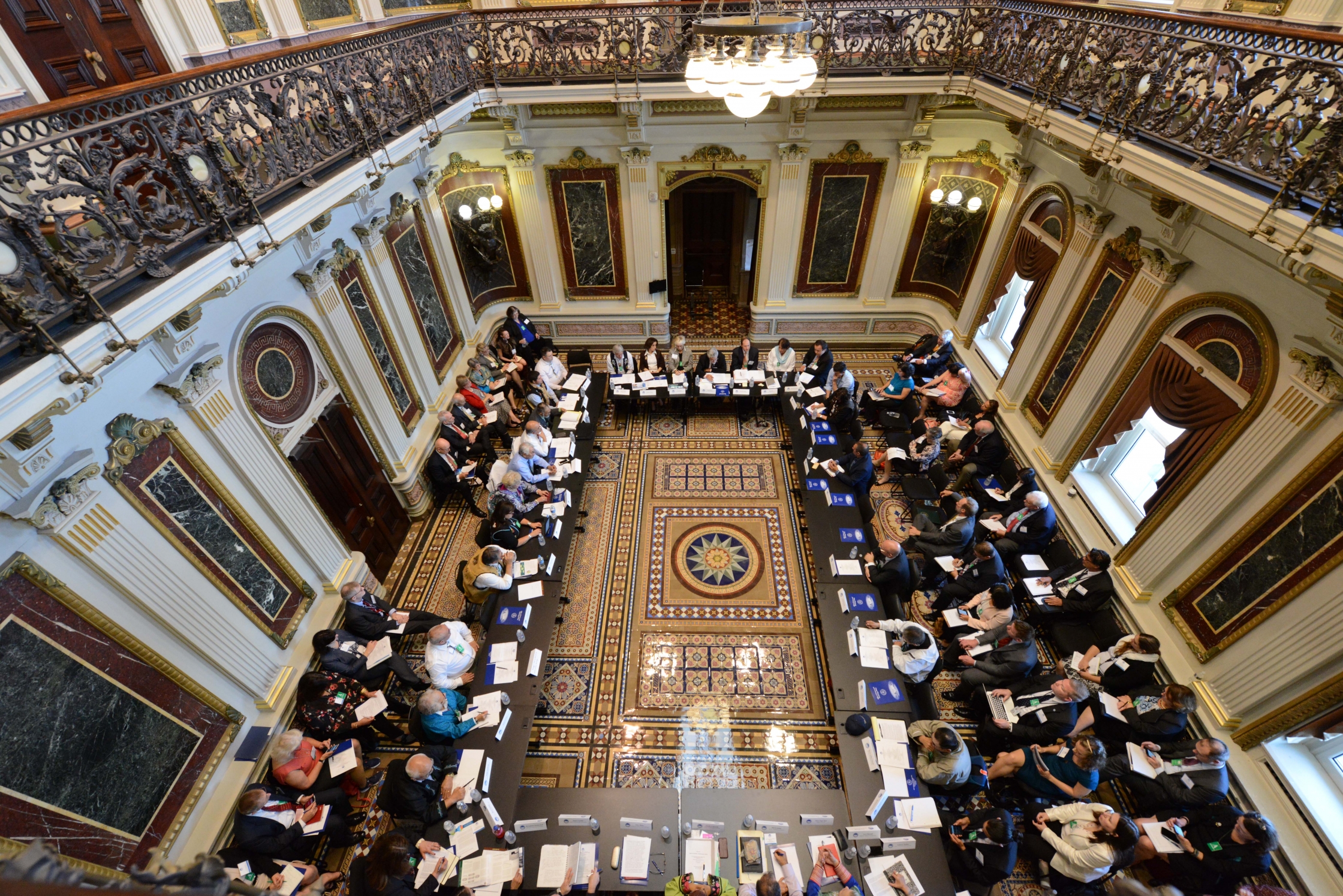
During the Summer of 2017, the PIRE team made a research trip to the Russian cities of Salekhard and Vorkuta. Here we present some of the student descriptions of the trip. 

July 9:

Anna Zhu

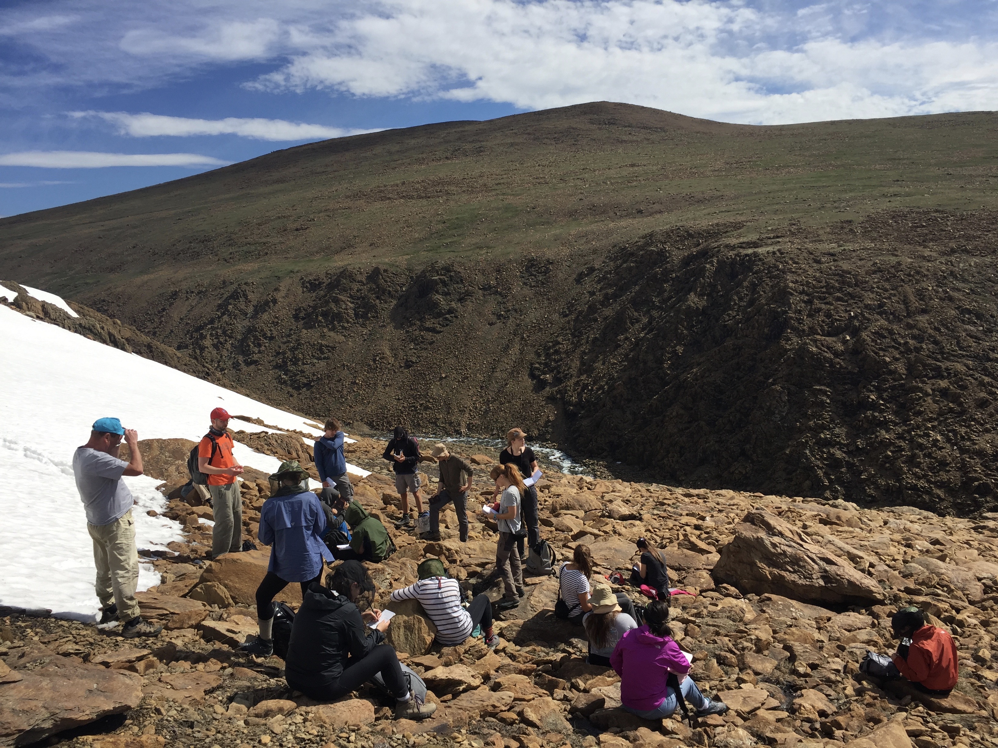
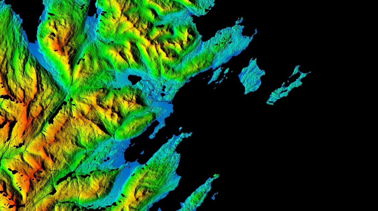
Of the 11 glaciers that previously existed in the region, only 2.5 remain. Today, we journeyed to the Ray-Iz glacier and plateau region of the Polar Urals. Formed during the Jurassic Era by active volcanic fissures and surface lava flow, the region and its glaciers are extremely important indicators of glaciation evolution and climactic changes. The glaciers are unique as they are located at an elevation of 1,200 meters, which is below the snow line of 1,800 meters, and are formed solely by wind redistribution of snow from plateaus to cirques. This dry region was widely

T. Henning

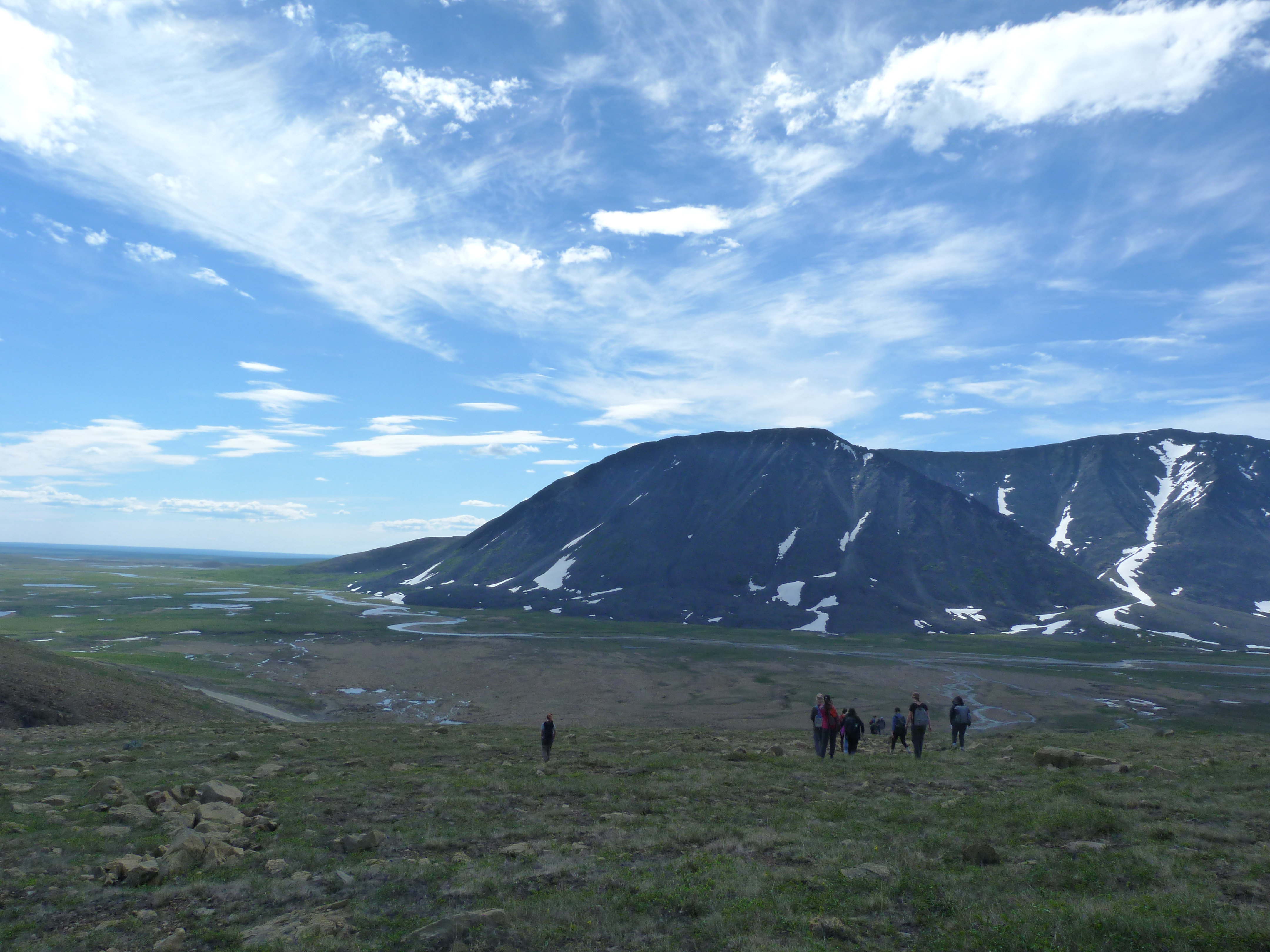
glaciated in the Pleistocene Era and is characterized by rare mineral resources in rock formations. We also observed many periglacial features, such as kettle and tarn lakes along with avalanche cones and talus.

Unfortunately, our hike was cut short when we reached frozen and icy conditions on the way to the glacier and it was too dangerous to proceed. From a distance, we learned that the glacier is receding and degrading. We then continued to observe the landscape, studying the varied ground patterns characterized by slopes, frost boils, and pingos. An earth covered ice mound, pingos are usually located in drained lakes where they have access to moisture. Groundwater moment and top down freezing combined with increased pressure forces water to move upward in the path of least resistance, raising the ground into a mound that creates the pingo formation. After learning about the landscape, we arrived at a river and completed our day with a picnic with a picturesque view.


9 июля:

Claire Franco

Сегодня мы поднимались в горы, чтобы посмотреть известный ледник в массиве Рай-Из, который находится на Полярном Урале. В 1960-ом году ученые нашли 11 ледников в этом районе, на сегодняшний день осталось только 2-3. По дороге на ледник мы проезжали поселок Харп, где находится “Полярная сова” – исправительная колония особого режима для пожизненно осужденных. Там заключенные собирают мебель. Вдоль дороги почти не встре чалась растительность, кроме некоторых видов трав. Но когда мы поднялись по склону, открывшийся вид с гор был похож на пейзаж Марса. На склоне горы, Валерий Иванович показал нам, как вода размывает горные породы, в результате чего образуются горные долины. К сожалению, дальнейший путь был опасен и наше профессора показали нам образование бугров пучений вместо этого.

T. Henning

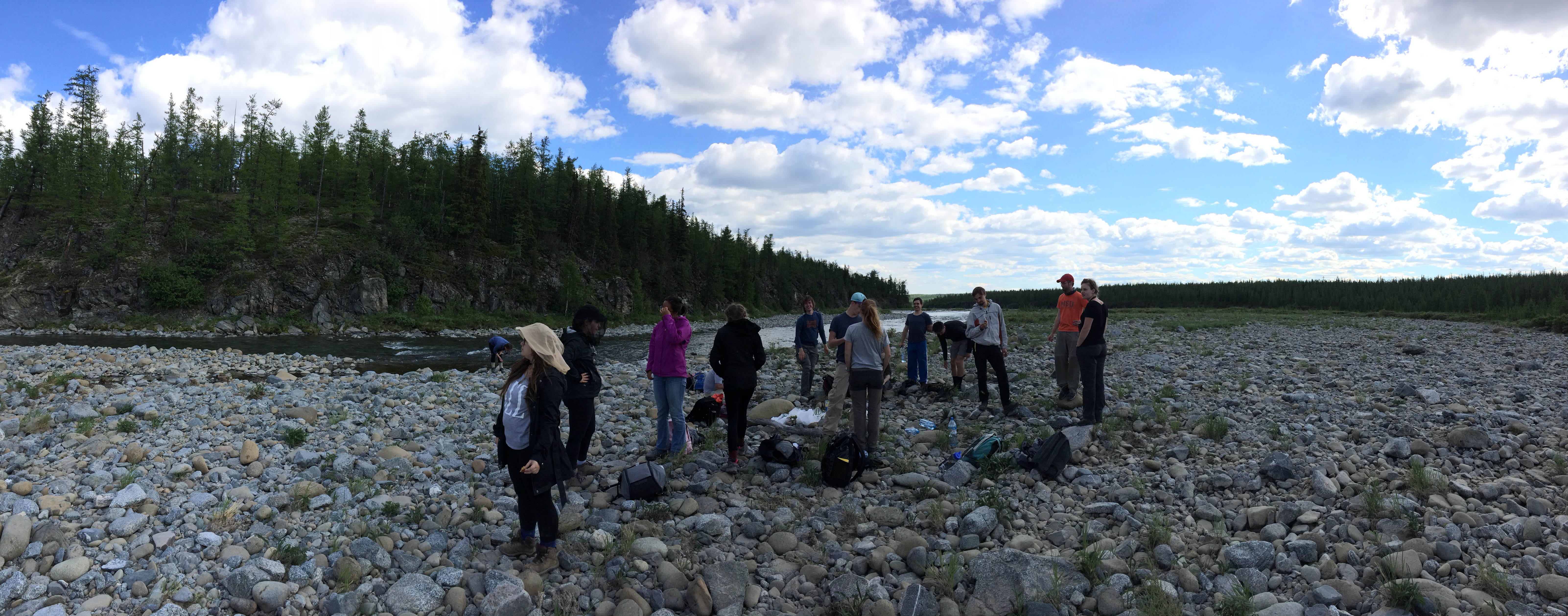
Мы обедали рядом с горной рекой. Никита, один из русских студентов, показал мне основные типы облаков в небе. Тереза из Германии научила нас пускать блинчики на воде реки.Наш прибрежный пикник закончился и мы поехали домой. Вечером в гостинице мы слушали студенческие доклады о Арктике.


July 12th

Nina Feldman

A. Sumi

The day started off a bit fishy. An aroma of excitement and curiosity filled the air as the students loaded the bus. We were off to visit a local fish factory in Salekhard. After being kindly greeted by the Director and Head Engineer of the factory, we were fitted with the appropriate factory attire. Sporting thin white coats and blue hair nets, we followed our hosts through a thorough tour of the production facilities. We saw how the workers canned, labeled, smoked and tested various types of fish. At the end of the tour the Director took us to a conference room that had a large spread of all the fish they sold at the factory ready for us to sample. The factory’s hospitality made for one of the most unique and exciting parts of the trip, and one I will remember.

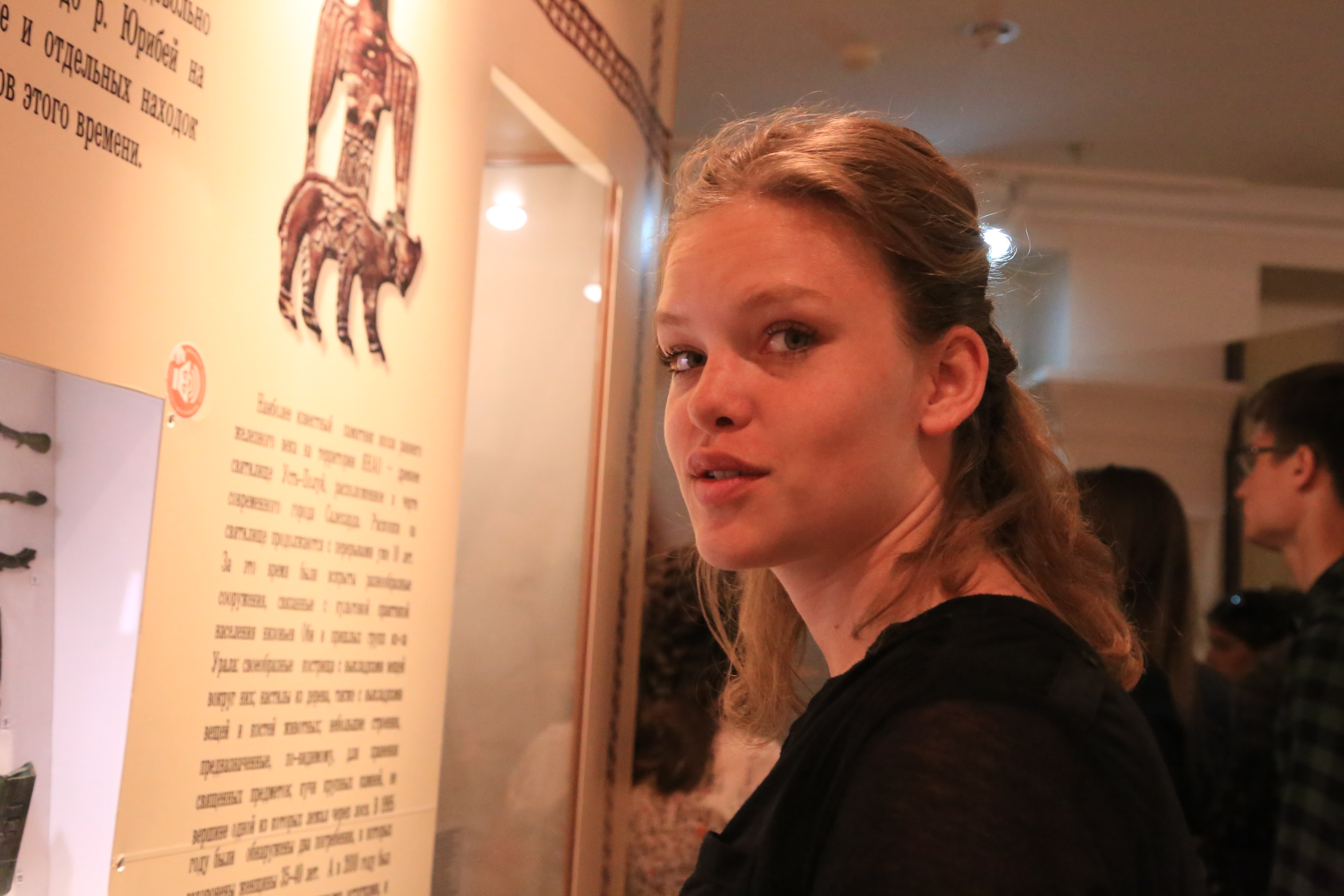
Following the factory fish feast was a day of museum touring. We started with the Craft Museum in Salekhard where we saw various artifacts carved by the indigenous people of Siberia. Intricate tusks displayed detailed carvings depicting different beliefs and stories of these people. Next was the Geology Museum in Labytnangi. This museum

U. B. Shpak

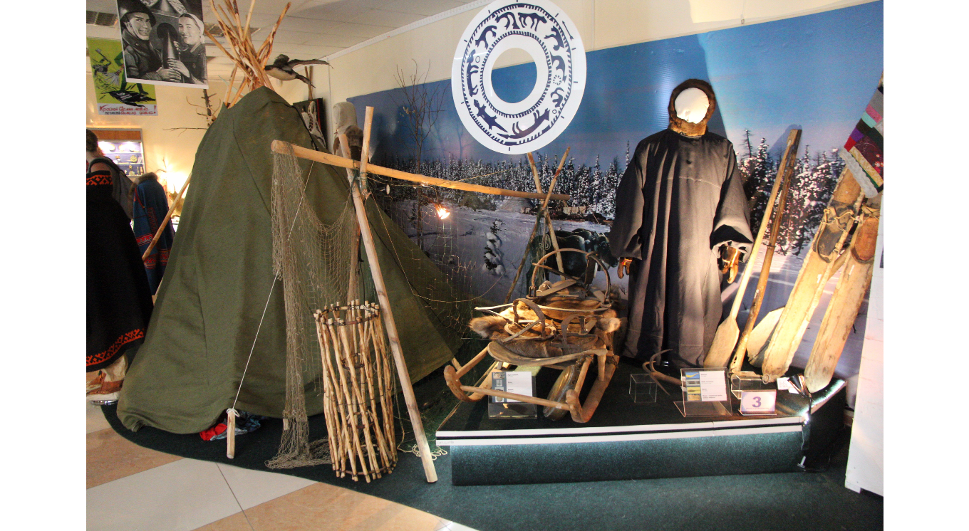
was definitely a diamond in the rough. The halls were filled with a large collection of minerals and stones extracted from around the area, as well as drilling samples and interactive exhibits that explained how they were able to find what they have found. We ended with a tour that took us back in time, following the lives of indigenous people throughout history. We learned how the Komi people used Birch bark to build their canoes and huts, and how the Khanty considered themselves to be descendants of bears and had a sacred bear festival every time one was killed.

What was great about this day is that through it all we were able to capture the historic, geologic and local feel of the region. As a result, we were able to gain a better understanding and appreciation of the community we were living in.


July 13th

Anna Sumi

U. V. Shpak

I’m one of those college students who got through my hard science requirements my freshman year, in a hurry and with my eye lids half open. So I think it’s fair to say I had no clue what it meant when we were told we would be “in the field” for the day. I nodded along in feigned understanding and put on my olive green farm boots as instructed before settling into the bus with a false feeling of preparedness.

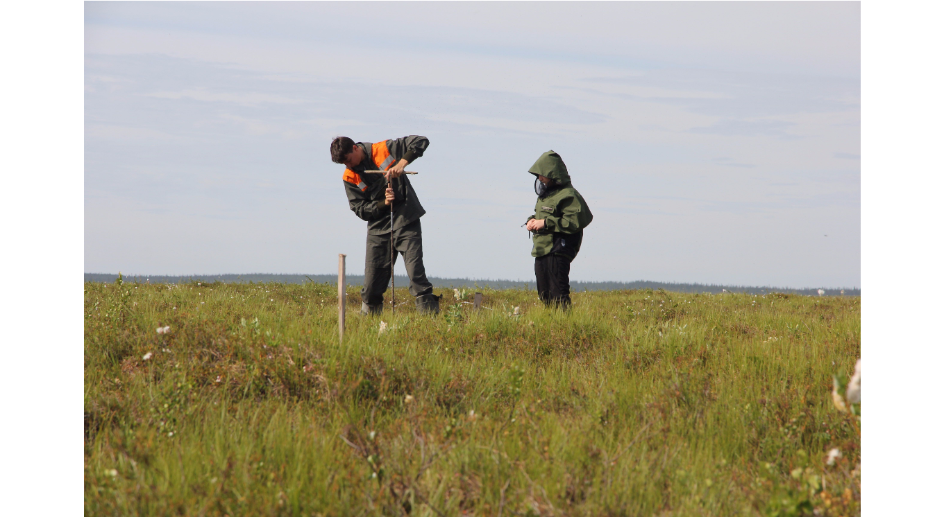
That day we were in the Tundra measuring active layer thickness and temperature. That day also presented the added challenge of pretending to act naturally as two Russian TV crews followed us around with their cameras. While I may have never felt completely prepared for the Tundra, at least I was not wearing a skirt and brocade tights like one of the journalists, who had clearly not thought through the landscape she would find herself in. I watched with a look of sympathy as she attempted to take a shower in bug spray.

U. V. Shpak

Somehow that ill-prepared TV anchor survived her day in the Tundra and later that night we gathered in Abby and Anna’s hotel room, crowding onto the two twin beds. The box of a television, sitting in the corner broadcasting the local news, held our full attention. After an hour of bated breath and hasty translations from the two of the group who had a light grasp on Russian, we realized they were not using our feature that night. Luckily, two minutes later, Luis walked into the room with his computer queued up to the broadcast from another channel. We huddled around that computer and giggled and gasped with recognition as our faces appeared on the screen. It was yet another once in a lifetime experience on our trip to Siberia.


July 18:

Claire Franco

In the morning, we collected our things and prepared for a 10-hour train ride west across the Polar Urals toward Vorkuta. At breakfast we learned that our train left two hours later then we had planned because all trains in Russia operate on Moscow time rather than local time. I used this extra minutes to finish some letters and send them through the local post office. Stamps for these two letters, one to California and one to Belarus, together cost less than $2.50 and I’ve made bets on how long each will take to reach its recipient.

Once our train was on its way, the usual rounds of card games and crossword puzzles began. The day before, I had expressed interest in Russian music to one of our GW professors, Nikolay Shiklomanov. In preparation for our long journey by train, he made a playlist of songs which loosely chronicle Soviet and Russian history from World War II until the 1990s. It began with war ballads made popular by Soviet

C. Franco

films, such as Two Soldiers (Два бойца, 1943) and Belorussian Station (Белорусский вокзал1971). Then came the bards like Vladimir Vysotsky (Владимир Высоцкий) whose music was typically self-published and consisted of only a single voice accompanied by a guitar. This genre is called bardovskaya (бардовская) or avtorskaya (авторская) music. The playlist included a song about Soviet-Jewish emigration to Israel and another about the human expense of the gulag system. The final decades of the USSR  were represented in the selection by the bands KINO (КИНО) and DDT (ДДТ), among others. This historical narrative in songs was supplemented by an MSU professor, Nadezhda Zamjatina, who wrote me her own list of significant music, films, and literature, focusing on those related to the Arctic territories.

The train was extremely warm and we were all grateful to arrive in Vorkuta, where the night time hours were only slightly darker and the city’s European orientation was immediately more evident in the architecture.


July 19:

Anna Zhu

The professors organizing the trip have long collected ice data in Siberia as part of a project known by its acronym CALM. Located approximately 10 kilometers outside of Vorkuta, CALM Site 2 rests in a typical southern tundra landscape. Established in 1996, this CALM site collects active layer depth, temperature, and soil moisture data and monitors the spatial variation of landscapes. Taller shrubs, dwarf shrubs, and willows characterize the typical southern tundra landscape. There exists no permafrost under taller shrub vegetation, while there is extremely shallow permafrost under dwarf shrubs. Observations of the extremely dry landscape show that the south-facing slope exhibits colder conditions with a shallower active layer. The north-facing slope, on the other hand, exhibits warmer conditions and a deeper active layer. This difference in conditions is largely due to winter snow and wind redistribution following typical wind patterns. The permafrost in this region is highly sensitive to local environmental conditions and anthropogenic impacts, resulting from former agricultural and railroad use. We collected some active layer and vegetation data around CALM Site 2 so that we did not disturb the actual CALM site. Then we all participated in a tundra “polar plunge” to end our day, finally refreshed from a long, hot day in the field.

A. Sumi
A. Sumi


July 21st:

Nina Feldman

C. Franco

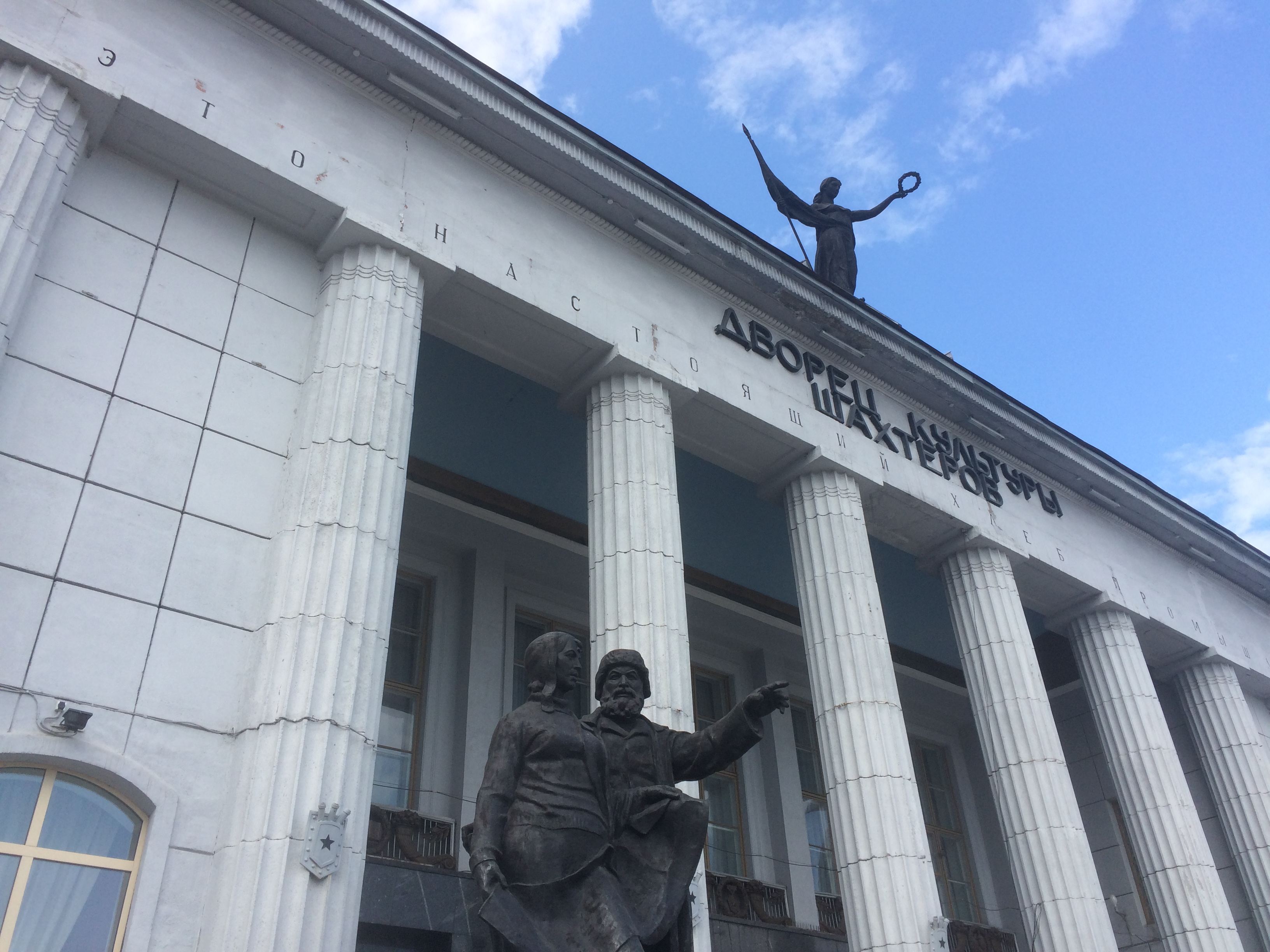
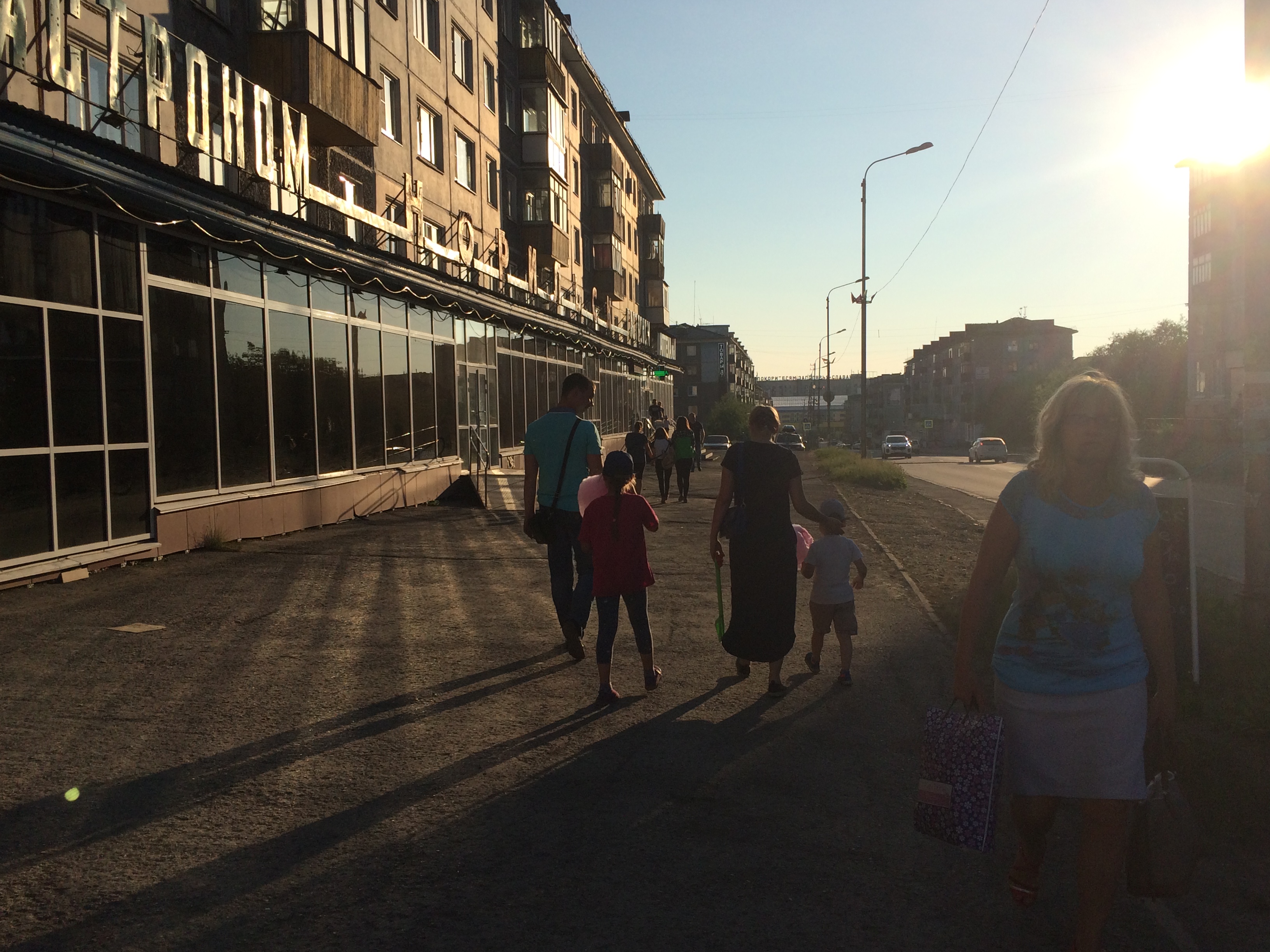
Today we spent the day walking around Vorkuta. After having lived here for a few days, exploring allowed us to feel closer to the people and their community. We traveled around, noting buildings with unique architecture as well as the significance they held. One building that stood out to me was the “Дворец культуры шахтеров” or the “Miners Culture Palace”. With numerous large columns at its entrance and an elegant metal statue placed above at its center, it truly demanded attention. After the day of touring, we were able to have a sit down meeting with the city managers of Vorkuta. We talked about their challenges, strategies and thoughts on planning and organizing such a unique city. With changing extreme climates, fluctuating populations, and a sense of consistency needed in the community, it takes a keen sense of creativity and meticulous thought to develop a city like Vorkuta.

C. Franco

Out of the entire day, my favorite moment would have to be when Moscow State University Professor Valeri Ivanovich took us to his childhood bakery shop, “Лакомка”, where he treated us to pastries and tea. This shop definitely stood the test of time, running for over 40 years with its delicious eclairs, donuts, and cookies. This being our last day in Vorkuta, there was a bittersweet feeling. However, I wouldn’t want to spend it any other way then surrounded by friends and colleagues in a cute little pastry shop talking about our time in Vorkuta over some tea and delicious desserts.


July 23rd:

Anna Summi

Maybe it’s because just a few days ago we spent over 10 hours in a train compartment that doubled as a sauna. Or maybe it’s because no one thought that travelling to Siberia in July could’ve easily been mistaken for a trip to the tropics if you closed your eyes, if only for the high temperatures and constant bug buzzing halo. But the feeling of relief and refreshment that swept through the group as we realized the train that we would attempt to call home for the next 40 hours was air-conditioned was instantaneous and all encompassing.

The entirety of today will be spent zooming, at the hyper-speed of around 50 mph, toward Moscow and the reality of the lives we left in America for the past month. Throughout the compartment, over meals in mess kits of bread and cheese and maybe the odd cup noodles, conversations of reflection and fond memories of the trip have begun. I don’t think anyone really knew what to expect when we all met at Dulles nearly three weeks ago, but without a doubt, this experience will stick with each one of us for a long time to come.

L. Jongejans
T. Henning


Report on International Field Course on Permafrost and Urban Sustainability: Salekhard and Vorkuta

During the summer of 2017, the PIRE team made a field trip to Salekhard and Vorkuta in Russia. Here we present a report on the trip from GW Grad Student Luis Suter.

This research trip represented an evolution of a 10-year annual field course, started by the GW-based Arctic CALM project. The field courses were originally focused on educating students on the proper field methods for collecting and measuring permafrost characteristics such as ground temperature, soil composition, and 

Fig. 1

monitoring changes in active layer thickness. With the integration of the Arctic PIRE project, the field course was expanded to include Arctic urban sustainability themes. These included resource-based boom-bust cycles, urban planning and governance, migration-related social issues, and economic diversification. 


The field course also focused on promoting exchanges among the international group of students participating.

Fig. 2

The course included students from the United States, Russia, Germany, Netherlands, Spain, and Switzerland (Figure 1). This group, led by four instructors, visited Salekhard in the Yamal-Nenets Autonomous Orkrug and Vorkuta in the Komi Republic (Figure 2).

Students spent alternating days conducting fieldwork in the tundra and in these cities, while participating in nightly lectures given by both students and professors. Students learned to consider sustainability in the Arctic as an interdisciplinary issue, related to both physical variables such as climate, permafrost, and geology and anthropogenic factors including economic development, migration, and governance.


Fig. 3

In the tundra, the group undertook the collection of permafrost and active-layer data in a variety of Arctic landscapes. The students learned traditional techniques, as well as modern technologies, used to measure environmental parameters important to permafrost health (Figure 3).

Fig. 4

Aside from these principles of geocryology and how this data can be used in research, students discussed the visible impacts of anthropogenic influence and climate change on the field sites. The impressions of human activity were near-constant, from the scars of old vehicle tracks covered in cotton-grass (Figure 4) to contemporary roads and rail-lines.

While in the urban settings, students engaged with local government officials, urban planners, research centers, museums, and universities to learn about socioeconomic and governance issues in the Arctic. Meetings and presentations with research organizations, including the Arctic Research Center and Center for Economic Development, produced valuable connections for the Arctic PIRE research network. By visiting Salekhard, a city rich with gas resources, and Vorkuta, a declining coal-mining city, students were able to learn about the effects of boom-bust economic cycles through living realities

Fig. 5a: Salekhard
Fig. 5b: Vorkuta

(Figure 5). Discussions with local representatives from both cities allowed this international group to debate concepts and strategies for sustainable development in the region, particularly in the face of a rapidly changing climate.

Encouraging the ability to view an issue from multiple angles is critical. The exchange of ideas between this diverse group of students, professionals, and locals promoted the growth of this international perspective through research and education. For many students it was the first time in the Arctic. Through their first-hand exposure to the complex interactions of environment, economics, society, and politics within the region, these students walked away as improved scientists and global citizens.

Inaugural Arctic PIRE Meeting is a Resounding Success

screen-shot-2016-10-25-at-12-27-32-pmThis past weekend, we were delighted to host the inaugural annual meeting of the Arctic PIRE: Promoting Urban Sustainability in the Arctic project. Roughly 30 members of our international research network were in attendance, discussing issues including the framework for our Arctic Urban Sustainability Index, the selection appropriate sustainability indicators, and strategies for strengthening the outreach of our important research. We also discussed future research trips to the Arctic, cooperation with media organizations, such as Planet Forward to increase our accessibility to new audiences, and the creation of an educational resource database for Arctic Sustainability issues.

screen-shot-2016-10-25-at-12-31-32-pm screen-shot-2016-10-25-at-12-31-00-pm

The conference culminated with a Public Panel discussion on Friday, October 21st, where over 50 members of the public visited The George Washington University to attend the event. Attendees included professors and students, as well as representatives of the National Science Foundation, embassies, and think-tanks based here in Washington DC. As our project builds momentum we will continue to look for more opportunities in research cooperation and outreach, in order to maximize the outreach and accessibility of our project. A full meeting report including notes and results will be published soon!

screen-shot-2016-10-25-at-12-28-48-pm

Shaky Foundations: Urban Areas built on Disappearing Permafrost

Last week, three of our distinguished researchers, Dmitry Streletskiy of The George Washington University, Valery Grebenets of Moscow State University, and Oleg Anisomov of Russia’s State Hydrological Institute, were featured in a Guardian article on the effects of thawing permafrost on Arctic cities. The Russian city of Norilsk, discussed a few weeks ago in this blog, stood at the center of attention. This time the focus was on the condition of buildings and the housing stock, which is suffering as a result of thawing permafrost. This issue is well known within Russia with Valery Tereshkov, the deputy head of the emergencies ministry in the Krasnoyarsk region, writing an article a few weeks ago stating that nearly 60% of all buildings in Norilsk have been deformed in some way. Problems caused by climate change and thawing permafrost have also been on the radar of global media, but mostly through the traditional Arctic lens of remote islands and coastal settlements being eroded, or indigenous communities having to move from their ancestral homes. The Guardian article was one of the first times that the global media examined the effects of climate change and thawing permafrost on the scale of a major Arctic city.

Figure 1: Location of Norilsk Photo Credit: BBC
Figure 1: Location of Norilsk
Photo Credit: BBC

Both in terms of population and economic output, Norilsk is one of the most important Arctic urban centers. With local engineers estimating that more than 100 residential buildings, about one-tenth of the housing stock, “have been vacated here due to damage from thawing permafrost,” this city is facing an existential crisis. Thawing permafrost under vital infrastructure is not a new problem for Arctic engineers, who have been building in the Arctic for many centuries with the largest development happening in Russia. Arctic PIRE member Valery Grebenets of Moscow State University regularly lectures his students on these issues, which include buckling roads, soil runoff killing flora and fauna, and the release of toxic substances trapped in the ice. These experts are also familiar with impact of urban areas on permafrost, such as the heat given off by buildings through their foundations. For many decades, engineers have been finding creative solutions to offset these “technogenic factors,” such as placing buildings on stilts to lessen their transfer of heat into the ground. However, none of these engineering plans took into account the effect of global warming, which has deepened the yearly permafrost thaw and significantly increased the speed of natural degradation. With the Arctic experiencing annual temperature increases that far exceed those recorded in the rest of the world, this ongoing crisis looks set to increase in scale and severity.

Figure 2: An example of the effects of thawing permafrost on a news-stand in Norilsk

Unfortunately, when infrastructure and buildings were planned, climate change was not taken seriously enough by city planners and government officials. As Arctic PIRE member Dmitry Streletskiy of The George Washington University told the Guardian, “In most cases the effect of climate change was not accounted for properly or at all, so the story is not about one building falling, even though there are examples of that, but about thousands of people living in buildings which have the potential to fall.” This is a clear example of the unfortunate lack of input that the scientific community often has in terms of planning for sustainable urban development. This issue compounded in the Arctic region due to the high cost of adapting cities to change. Our colleague Oleg Anisomov, Arctic expert and Nobel Prize holder, laments that the high north will suffer from lack of strong support in terms of government funding and strategic investment in adaptive engineering solutions. Our project aims to Promote Urban Sustainability in the Arctic hope to alter this trend and increase the voice of the scientific community in the Arctic through our upcoming Arctic Urban Sustainability Index and by increasing global attention on these important issues. Through continuous engagement and communication with policy makers, urban planners, and Arctic development planners, our scientific network will advise on the effects of climate and socio-economic changes to Arctic cities and help these important communities adapt to their rapidly changing surroundings.

Figure 3: A building is temporarily braced against collapse.

Global Attention Turns Toward the North

Alaska Indigenous community leaders communicate their priorities to the U.S. delegation to the Arctic Science Ministerial. (Photo Credit: U.S. Coast Guard Petty Officer 2nd Class Connie Terrell)

For many years, international dialogue about the Arctic has focused primarily on the clichés of stranded polar bears and a romanticized vision of a final frontier. In reality, the Arctic is a region that is incredibly more intricate, with complex and intertwined social, economic, and environmental systems. One goal of this project is to increase awareness of the Arctic as a complex region among policy makers and the public. This week, Washington DC played host to the first White House Arctic Science Ministerial, where representatives of the eight Arctic States, fourteen additional States, the European Union, and Arctic Indigenous communities met to assert the importance of improving collaborative science efforts in the Arctic.[i] This is welcome news to our network, which very much look forward to contributing to this growing, and vitally important, dialogue.

As with any major political event in Washington DC, coverage from the media soon followed. The Washington Post wrote a featured piece covering the warming of the Arctic climate and the growing political attention on the region.[ii] One overarching theme throughout these different press briefings and articles is the focus on international cooperation. With so many different nations and communities represented in the region, it is important to include all these actors when planning for the future.

Another big focus of the White House Ministerial and its press coverage was the need to increase observational capacities in the Arctic. Accordingly, the meeting announced the “release of a new satellite-based dataset that maps elevations across the Arctic at a resolution of 8 meters, with an expected further improvement to 2 meters next year.”[iii] The ministers also highlighted a number of new projects in the region “to record and evaluate the large volume of environmental changes being observed by the Arctic’s indigenous peoples in and around their communities.”[iv] By inviting local populations to share their knowledge of changes and opportunities to adapt, these projects aim to increase the awareness of Arctic issues and help prepare the region to take advantage of the opportunities resulting from the the rapid changes already underway.

This remotely sense digital elevation model is an example of the imagery that is being made available through increased scientific interest in the Arctic. Remote sensing in the Arctic is hindered by challenges like frequent cloud cover and a lack of sensor coverage. (Photo Credit: Paul Morin, PGC)
This digital elevation model is an example of the imagery that is being made available through increased scientific interest in the Arctic. Remote sensing in the Arctic is hindered by challenges like frequent cloud cover and a lack of sensor coverage. (Photo Credit: Paul Morin, PGC)

The same changes that affect local indigenous communities will certainly affect Arctic urban populations, and as a result will have secondary effects on the social and economic systems of the region. Our project aims to create an index to rate the progress of sustainable development plans initiated in the region. This project will help assess the progress of such developments, focused on integrating locally sourced knowledge from our vast network of international research partners. It is our hope that by building a tool to measure sustainable development plans across the region, we can encourage cooperation and mutual learning.

[i] https://www.whitehouse.gov/the-press-office/2016/09/28/joint-statement-ministers

[ii] https://www.washingtonpost.com/news/energy-environment/wp/2016/09/28/the-arctic-is-being-utterly-transformed-and-were-just-starting-to-learn-the-consequences/?tid=sm_tw&utm_term=.426bf80de924

[iii] Ibid.

[iv] Ibid.

Panel Discussion at Inaugural Arctic PIRE Meeting

conference-flyer-oct-2016

From October 20th-22nd we will be hosting the inaugural annual meeting of the Arctic PIRE team, here in Washington DC. To culminate this multi-day conference, we are proud to invite you to a panel discussion led by some of our foremost experts in Arctic Sustainability from around the world. Speakers in this panel will address topics including: social sustainability in Arctic conditions, the economic role of cities, Arctic urban planning, and the political framing of sustainability in the Arctic. A reception will follow the panel discussion, providing the public and policy-makers an opportunity to network and forge relationships with our network of international research partners. We would love to see you there!

Please RSVP at: go.gwu.edu/arcticpire

PDF of Event Flyer: conference-flyer-oct-2016

The Red River of Norilsk: How the Remoteness of the Arctic Amplifies Environmental Disasters

57d034d9c36188bd428b4689
Figure 1: Discoloration of the Daldykan River Source: https://www.rt.com/viral/358561-red-river-siberia-norils

Last week the world was shocked by images of a blood red Daldykan River in central Russia (Figure 1). The cause of the unnatural coloration was the spillage of slurry over a filtration dam near the Russian city of Norilsk. The economy of Norilsk is dominated by mineral extraction and processing, with the mines and factories around the city producing 13% and 44% of the world supply for Nickel and Palladium respectively.[1] This makes Norilsk an economic powerhouse, however also gives Norilsk Nickel, the operator of the various mines around the city, a very powerful influence on the political operation of the city as well as the media.


While the spill occurred around September 5, Norilsk Nickel did not admit responsibility for the spill for nearly a week, even publishing pictures on their website of the Dalydykan River in “regular condition and show[ing] the natural color,” on September 8th. [2] It was only after significant exposure on social media, as well as in the world media, that the company finally took responsibility, issuing a statement that “”On the 5th of September after abnormal heavy rain, overflow of one of the dikes occurred, and [contaminated] water entered Daldykan River.”[3] However, the company insists that there is no danger to humans or river flora / fauna and that they were taking steps to improve safety precautions for future incidents.

Heavy industrial pollution is not a new issue for Norilsk, which has often been cited as one of the most polluted cities on the planet.[4] In fact pollution had reached such high levels that in 2010 Vladimir Putin threatened to heavily fine Norilsk Nickel if steps weren’t taken to modernize the plants and reduce pollution.[5] Norilsk Nickel has pledged to invest over $3.5 billion in plant upgrades by 2020, a welcome step for residents who suffer from the toxic pollutants in the air.

_91067874_5b051dc2-7e3c-4675-aea8-6293d9c9418b
Figure 2: The remote location of Norilsk and the Arctic Region Source: http://www.bbc.com/news/world-europe-37345105

These steps being taken to modernize and reduce pollution are a good sign, however this most recent spill shows that the Arctic region is still extremely vulnerable to environmental contamination. The denial of responsibility for the spill by Norilsk Nickel is a perfect example of the worrying lack of strict governance in the region. The isolated nature Norilsk (Figure 2), with restricted access to industrial sites is indicative of the lacking environmental of oversight in the Arctic. Moreover, the companies operating in the area are not motivated to report spills, admit liability, and pay expensive cleanup costs, leaving it up to the media or civil-society to investigate these occurrences. Without the intense Social Media reaction to the ‘red-river of Norilsk,’ and its dramatic pictures, there is little doubt that the spill would have been swept under the rug or denied further.

untitled
Figure 3: A map showing the vast, remote, area affected by the Exxon Valdez Spill. Over 1500 miles of coastline were affected. Source: https://feww.files.wordpress.com/2009/06/exxon-valdez-spill-map.jpg

Unfortunately, this reaction to environmental disasters in the Arctic is not limited to Russia. Following the 1989 Exxon Valdez spill in Alaska, and up until present day, Exxon Mobil has tried to downplay the amount of oil spilled, and the amount of oil leftover in the area after cleanup.[6] The company was still involved in legal battles fighting against the responsibility for continuing environmental damage in 2006.[7] However, studies have shown that the vast area affected by the spill (Figure 3) has not fully recovered, both in terms of fauna population levels, and economic output.[8] Again, the remote nature of the Arctic and the fragility of the ecosystems in the region amplify the magnitude of spills, while the remote nature of the region with its relatively small populations and weak governance lessen the motivation for polluters to take responsibility. As oil exploration and general resource exploitation in the Arctic grows, we can expect more incidents like the Valdez and the Daldykan River. How regional actors respond to these inevitable disasters will help define the progress sustainable development in the Arctic.

References:

[1] http://www.nornik.ru/en/investor-relations/fact-sheet

[2] http://www.nornik.ru/en/newsroom/news-and-press-releases/news/the-daldykan-river-photo-the-river-and-its-mainstream-are-in-regular-condition-and-show-the-natural-color

[3] http://www.cnn.com/2016/09/12/world/russia-red-river-siberia/

[4] http://www.blacksmithinstitute.org/the-2007-top-ten-of-worst-polluted-places.html

[5] https://www.theguardian.com/cities/2016/sep/15/norilsk-red-river-russias-most-polluted-city-clean

[6] http://www.adn.com/economy/article/size-exxon-spill-remains-disputed/2010/06/06/

[7] http://www.abc.net.au/news/2006-05-17/exxon-valdez-oil-spill-still-a-threat-study/1755518

[8] http://publish.wm.edu/cgi/viewcontent.cgi?article=1020&context=caaurj