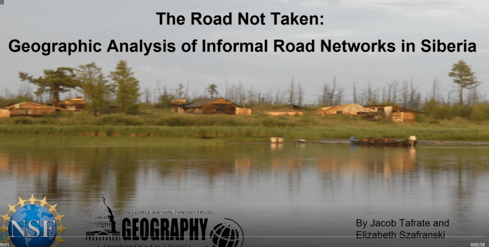

Listen to this Nashman Prize presentation here.
This presentation is a submission for the Nashman Prize for Community Based Participatory Research (CBPR). This approach to inquiry is aimed at informing solutions to benefit the community, through collaboration with community members in all stages of the research process, including determining the research question and inquiry method(s), data collection, and dissemination of findings.
Help select the Symposium Audience Choice Award. Click on this link to cast your vote for best Symposium presentation.
Really enjoyed this presentation on a topic I am not at all familiar with. Definitely learned a lot!
So glad students from the Elliot school are presenting! And, you're first and second year students, this is huge. I really enjoyed hearing about your work, can't stress this enough. Are you able to talk a little more about yourselves? And discuss how and why you chose this topic?
I think your incorporation of interview quotes was great, they strengthened the community focus of your presentation and demonstrated that your research began with local leaders' experiences. Is this an accurate characterization? The quotes also provided a transition to discuss local "subsistence communities" and "natural systems." Did you personally interview local leaders?
Do you see yourselves as advocates for international geographic development? Or, do you believe that the goals of your project align more with a different pathway of service (Community Engaged Learning and Research, Direct Service, Policy and Governance, Community Organizing and Activism, Philanthropy, and Social Entrepreneurship and Corporate Social Responsibility)? I don't encourage you to apply the pathways of service to your project, this may urge you to choose one pathway that best represents your project. Instead, you can apply your project to the pathways of service and see how many different areas it aligns with.
You may have said this in your presentation, but why was there an increase in informal road networks?
Lastly, you noted that you worked with the National Science Foundation and GW's department of Geography & Environmental Studies. How would you characterize your relationships with NSF, GW's department, and the local communities you worked with?
Hi Maureen, thank you for your interest in our project. Due to the language barrier and remote location of communities discussed in the project, unfortunately we did not personally interview the local leaders. We have been working closely with the NSF grant lead, Dr. Vera Kuklina, who is originally from the region. She provided us with the interviews and many photographs seen in the presentation as she regularly travels to the locations discussed. Additionally, there are several faculty members in the GW Geography department who supported our work and helped connect us to the community remotely. Liz and I are both passionate about the effects of climate change and land use rights regarding front line communities, which resulted in our interest and involvement in the project. With continued involvement and as we advance in our studies we hope to visit the study areas and participate in future interviews and related field work.
Thank you for your advice on incorporating pathways of service. We are not simply advocating for geographic development because of the wide array of issues and opinions of residents, local government, and industry surrounding land use rights along these informal road networks. We believe this work will apply to ‘community engaged learning and research’ when our map products are shared with the community and they will evaluate their accuracy and possible applications. Those applications may then apply to a ‘policy and governance,’ ‘community organizing and activism,’ or ‘social entrepreneurship and corporate social responsibility’ pathways if they believe there could be application with establishing local rules and regulations surrounding informal road construction, use, and maintenance.
Much of the development observed is the result of increased logging and hydrocarbon extraction in the region over the last several decades. These industrial activities involve building temporary access roads and easements that local indigenous peoples continue to use once extraction has finished. This brings with it both new opportunities and challenges for the indigenous Evenk people in the study areas.
Liz and I both work with the Geography department to support the work of Dr. Vera Kuklina in the field. We have had multiple meetings with Vera Kuklina where she outlines the work being done for the NSF and project as a whole. These included her direct interactions with community members, photos from the study areas, and her input ways we can best contribute to the project. From here, Liz and I attended weekly meetings with department faculty where they would introduce us to new techniques in ArcMap and GoogleEarth Pro, and then assess the spatial data and maps we generated (shown in the presentation). We both hope to develop personal relationships with community members as we continue to work on this project and communicate with locals about assessing the accuracy of our map products.
Our position thus far has been focused on digitizing road development in the study areas. From here we are working with Dr. Nyland and Dr. Shiklomanov to identify and map hazards in the region. A hazard map will be given to Dr. Kuklina who will share our geographic analysis with the community. Through resources and expertise available in the department we are currently in the process of identifying road networks most at risk with the long term goal of supporting sustainable development within the region.
Jacob, thank you so much for your thoughtful response. I really enjoyed learning more about you and Liz and your ongoing work. So much work went into this, I appreciate the details provided above. I hope that you and Liz are able to return to the Symposium and present again next year.
Your technology and visuals to show change over time is very effective. I'm not familiar with this topic, but I am happy to see new subjects being explored in these presentations. Great work
Thanks for sharing your work - it would be great to here more about the follow up with the community and how you did/will share the data with them? Is this the start of a long term research project for you while at GW?
Hi Rachel, thank you for your interest in our project. Yes, the information presented here is the start of a long term project involving increased involvement and collaboration with community members in the future. The information will be shared when the hazard analysis is completed sometime over the summer or early next year.