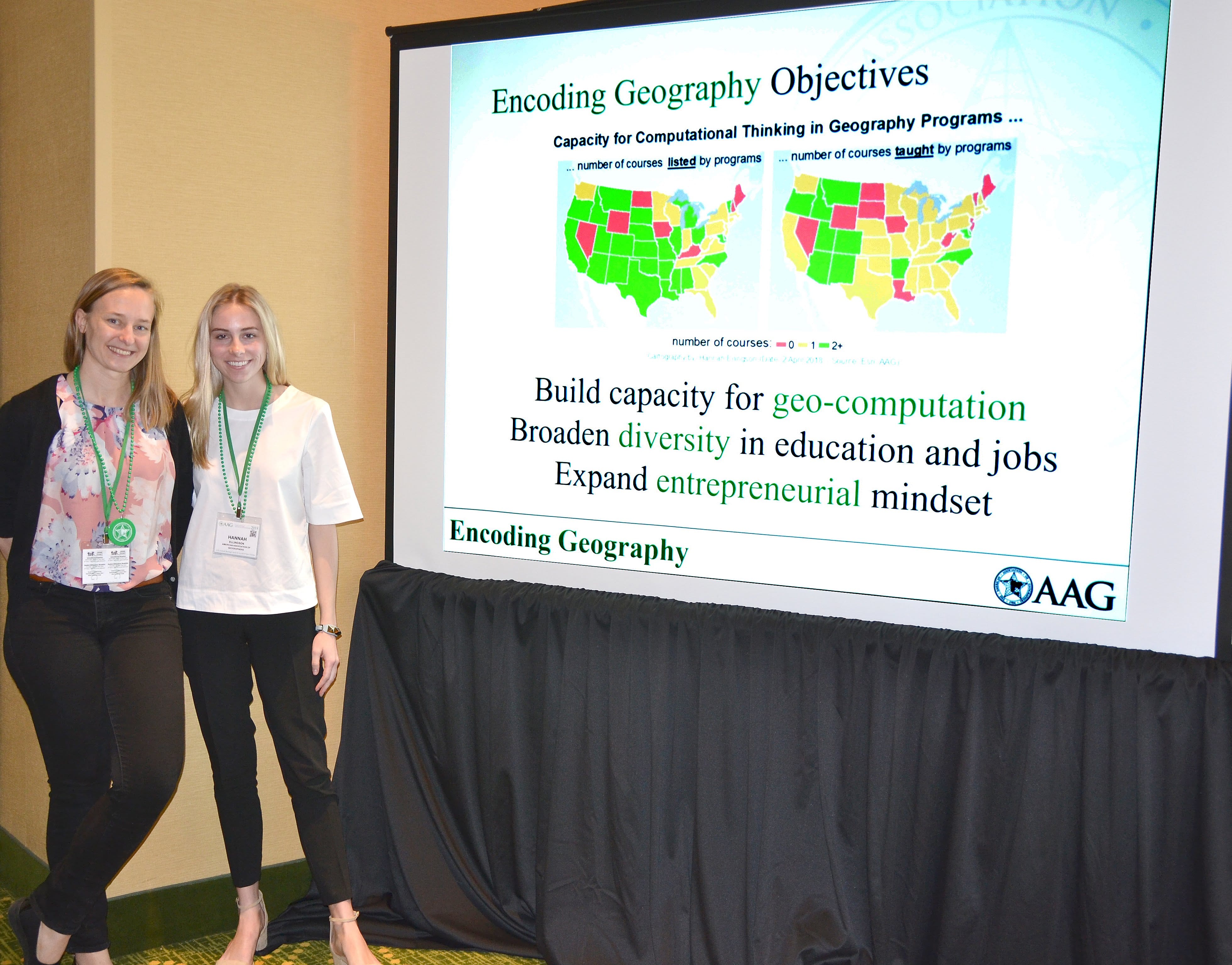
For the second installment of Geography "In the Real World"-- where we showcase the accomplishment of GWU's Geography, Environmental Studies, and GIS students as they take their geographic education into real world work/study experiences-- we interviewed junior Geography major and GIS minor Hannah Ellingson, Intern for the American Association of Geographers, Spring 2018.
How did you first get involved in the geography department at GW? How are you involved now?
I came to GW with a preexisting interest in geography that I developed in high school. Fall of freshman year I took Human Geography with Professor Dymond and Political Geography with Professor Cullen to see how I liked geography classes at the university level-- I loved both classes, particularly political geography! I declared a geography major and GIS minor at the end of my first year, and I’ve loved it so far.
What positions have you held in the field of geography?
So far, I have held two internships in geography—the first was over the summer after freshman year with the City of Norfolk's Department of City Planning. While there, I completed a research report on coastal cities in the US that had successfully turned their streets which end at the water into “street end water access points,” as the City of Norfolk was in the process of doing. I then used ArcGIS to map all streets in Norfolk that end at the water, then classified them according to their condition, in order for the city to consider real-world suggestions/initiatives to address the lack of public water access in the city and visualize the potential street-end water access points.
Also that summer, I had the opportunity to assist a professor from Illinois using LiDAR to map a one-mile section of the Klingle Valley Trail in DC. We spent 4 days from sunrise to sunset in the Klingle Valley, surveying the creek. The professor had surveyed the creek with LiDAR in the past, and he was looking at how the creek had changed over time. It was the hardest work I’ve ever done, but it was really fun to challenge myself and have that experience to relate back to my studies at GW.
The second internship was with the American Association of Geographers (AAG) during the spring semester of my sophomore year.
At the AAG, I did a lot of research and data management in Excel that related to job trends in geography in the United States and global access to geographic education at the university level. I also assisted a senior researcher with her initiative to increase coding education within geography departments in the US. Using ArcGIS, I mapped universities in the United States with geography departments that offer coding classes. Fortunately, I was able to travel with the AAG to their annual meeting in New Orleans, where I helped attendees explore job opportunities at the AAG’s jobs and careers table. I also assisted the AAG’s researcher present her Encoding Geography initiative, for which I created that map.

The 2018 AAG Annual Meeting was held in New Orleans April 10-14 at the Marriott and Sheraton hotels in the French Quarter.
What valuable skills did you learn during your experiences, and how have they shaped your thinking?
Both internship positions were very valuable to me for the experience I gained in GIS as it pertains to both government applications and nonprofit research. I learned a lot about how frustrating and rewarding ArcGIS can be when you’re completing a project that has no step-by-step instructions (as GIS labs do!) Both the internships and the research opportunity have given me insight into the breadth of careers available to geography majors. I think the most valuable experience was being able to attend the AAG’s annual meeting, where I was able to meet geographers in pretty much every industry.
How did your previous experience in geographic education at GW prepare you for this opportunity?
I think a better way to answer this question is to discuss how I have been able to relate these experiences back to my studies. They’ve really helped me connect my studies to the real world, since they took place pretty early on in my college experience, and mostly before I had taken the classes they related to. The City of Norfolk internship has really resonated with me as I’ve taken Intro to GIS and Intermediate GIS, because as I learn more about Arc, I find myself constantly thinking of ways I could use the concepts and techniques we learn in class to improve and further develop the water access project I completed during my time there. This semester, I’ve found that the LiDAR research experience relates to concepts in Remote Sensing.
Have you completed a geography-oriented internship? Job? Study abroad? Ad-hoc field work? Independent research? Let us know! We are interviewing current (and past) GW Geography students who have taken their geography knowledge into the “real world.” If you are interested in sharing your experience, please send an e-mail to siofinnerty@gwu.edu

